Xi'an Precision Measurement and Control (RTK) PA-GS02 MEMS integrated navigation
The quotes are provided by Several Partner Companies

- Prices: Request for a Quote for Further Details
- Model : (RTK) PA-GS02
- Category: Inertial Navigation System (ins)
- Brand : Xi'an Precision Measurement and Control
- Delivery Time: Request for a Quote for Further Details
- Manufacturer: Xi'an Precision Measurement and Control
Products
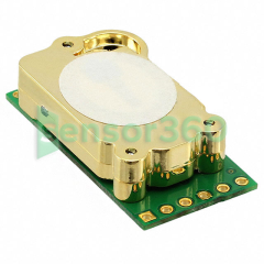
The enhanced integrated navigation system PA-GS02 is an integrated navigation system based on a high-precision inertial platform,integrated with differential GPS,and supports RTK. The system realizes functions such as differential dynamics,accurate orientation,RTK centimeter-level positioning,and high-precision attitude measurement.
The integrated navigation fusion algorithm is stable and mature. Fast alignment,fast response,fast convergence. The three postures are stable and reliable,and the positioning is fast and accurate. The algorithm optimizes the design for situations such as GNSS occlusion and multi-path interference. It can meet the navigation application of complex terrain such as streets,docks,forests,canyons and so on.
※ Three systems,6-frequency GNSS,high tracking sensitivity
※ Reliable and accurate heading output
※ Real-time RTK,centimeter-level positioning
※ Supports odometer,DVL and other multi-signal fusion
※Supported number
Data storage and post-processing applications
Space-based fields: unmanned aerial vehicles,aerial photography,agricultural plant protection,photoelectric detection stabilization
Land-based field: vehicle navigation,vehicle satellite communication,forest land monitoring,high-speed railway track inspection
Sea-based field: hydrographic survey,waterway detection,ship-borne positioning communication,unmanned sleeping vehicle
Performance indicators (typical values) | ||||
model | PA-GS02A | PA-GS02B | ||
heading | Heading (1m baseline) | 0.2° | ||
Heading (2m baseline) | 0.1° | |||
Heading accuracy (L1/B1 single point) | 0.3° | |||
horizontal position | Single point L1/L2 | 1.2m RMS | ||
RTK: | 1cm+1ppm | |||
Elevation accuracy | Single Point | 1.5m RMS | ||
posture | Dynamic | 0.3°(RMS) | 0.1°(RMS) | |
speed | three directions | 0.03m / s(RMS) | 0.03m / s(RMS) | |
Gyro | Measuring range | ±450 (optional 900) | ±300 (optional 800) | |
Bias stability | 10 °/h (Allen variance - 25℃) | 4.5 °/h (Allen variance - 25℃) | ||
Accelerometer | Measuring range | ±6 (±15 optional) | ±5 (±10 optional) | |
Bias stability | 5mg | 1mg | ||
receiver | GPS\ GLONASS | L1,L2 | ||
B1,B2 | ||||
Galileo | E1,E5b | |||
Output frequency | 5Hz | |||
magnetic sensor | Measuring range | 6Gauss | ||
resolution | 120uGauss | |||
Altimeter | Measuring range | 10mbar-1200mbar | ||
measurement accuracy | 1.5mbar | |||
Electrical Interface | ||||
power supply | Power supply range | 9V~30V | ||
Power consumption | <3W | |||
Communication | communication method | RS-422/RS-232/TTL | ||
update rate | Data update rate (IMU) | 100~400 | ||
Data update rate (posture) | 100~400 | |||
Download
|
2019051509491353489 |
4.05 MB | Click to Download |